Seolha Lee

Urban Governance
Data Science
Critical Design
Interactions between
Human - Place - Technology
Projects
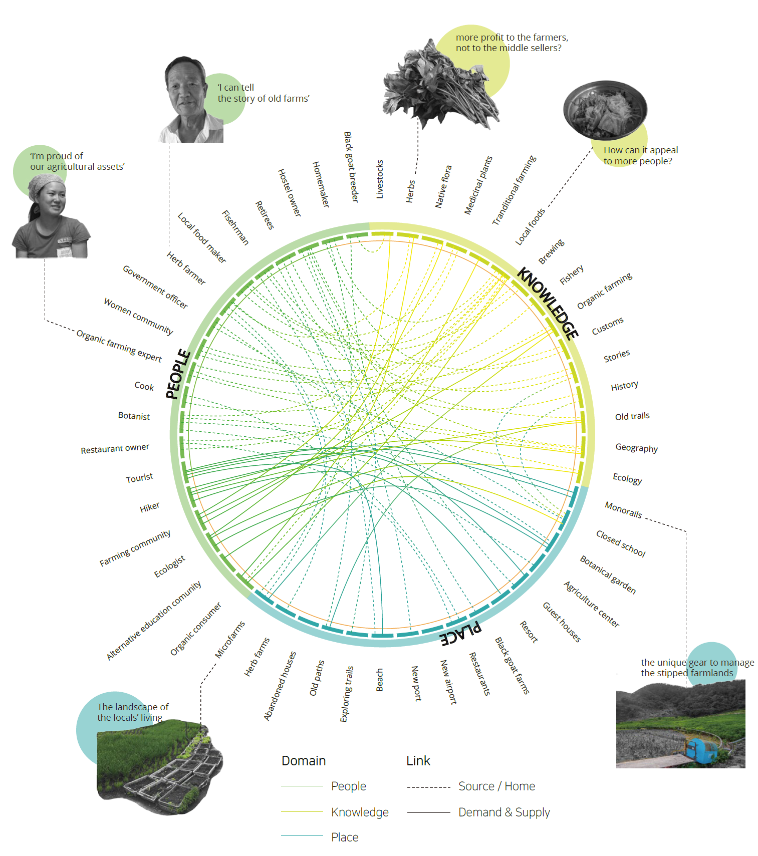
Data for Situated Storytelling and Decision-Making
Data is productive of relations and actions
Reconfiguring Data Relations: Institutional Dynamics around Data in Local Governance
Design & Ethnographic Study, 2022-23
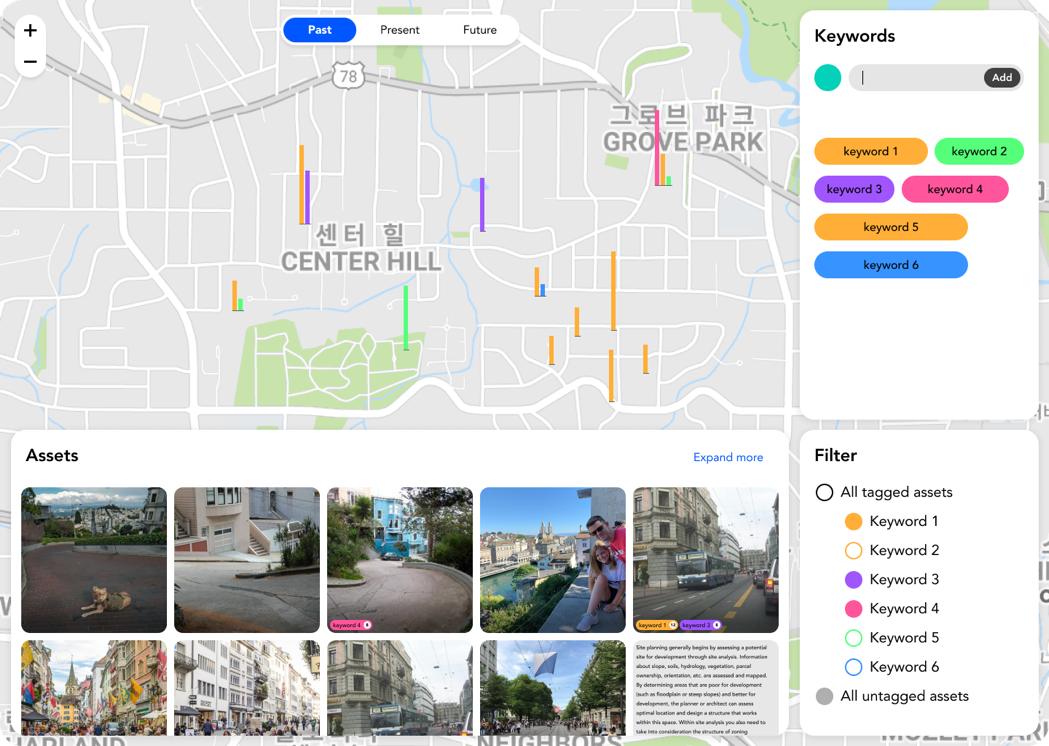
In this project, I designed and developed an interactive data dashboard called 'Neighborhood Data Board' in collaboration with a Planning Department in a city in California. The dashboard aimed to inform equitable planning decisions by providing nuanced information about communities' lives in the city's neighborhoods. The collaborative design process, which engaged planners, city staff, and community members, unpacked the gaps and conflicts in how the entities perceived data's role and value in improving equity in city governance and what organizational barriers existed in achieving the goals.
Interrupting Governments’ Data Performance: Critical Reading of Public Data Communication
Conference Presentation (Working paper), 2023
In this paper, we analyzed the public presentation of government city data initiatives as data performance through which governments earn legitimacy to control data's value and role in cities. Our analysis revealed two distinct narratives from the public presentations and their common storytelling structure. Demonstrating the critical analysis of the narratives focusing on government-citizen relations, we argue that critical reading of public data presentations through the lens of data performance could be a tactic of resistance for communities and activists pursuing data justice.
An academic paper about this project is under review
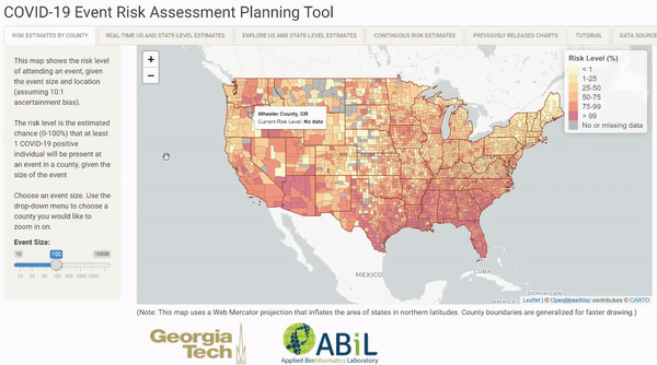
COVID-19 Event Risk Planner
Interactive Map, Web Development, 2020
I designed and developed an interactive map tool to inform the expected risk of gatherings and group events in each county in the US, as a part of the COVID-19 Event Risk Planner web tool developed by Weitz Team at Georgia Tech BioScience. The web app has been gathering huge public attention and featured in Fast Company, AJC, and other press.
Check out the current COVID-19 risk level of group events
Selected Featured Articles:
- MapLab: An Actionable Map of Covid Risk, Bloomberg CityLab, August 05, 2020 Link
- To Navigate Risk In a Pandemic, You Need a Color-Coded Chart, Wired, July 21, 2020 Link
- Is it safe to go to a local store or school? Real-time COVID-19 risk calculator helps you decide, FastCampus, July 13, 2020 Link
Socially Constructed Space: Place Dynamics and Digital Media
Places are socially constructed with experiences, knowledge, and interactions in physical and digital spaces.
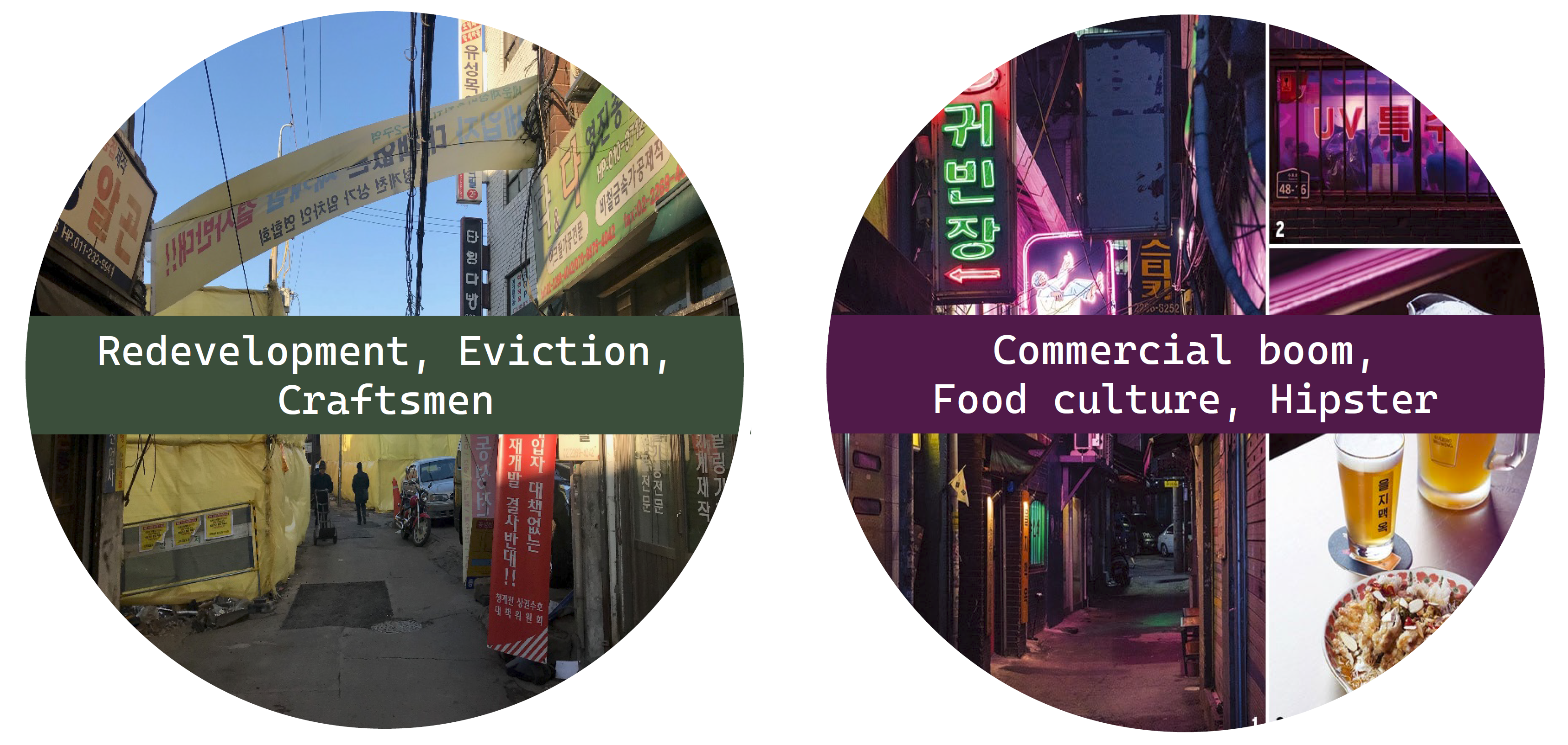
More Than a Property: Place-based Meaning Making and Mobilization on Social Media to Resist Gentrification
Conference Paper, CSCW 2023
This study examined the successes and challenges in counter-narrative building on social media in the context of place-based activism resisting urban redevelopment and gentrification. We conducted a qualitative analysis of online discourse on Twitter around the redevelopment of an old manufacturing district in Seoul, South Korea. While the place-based nature of the resistance complicated the public mobilization online, the collective meaning-making based on individuals' experiences and relations to the contested place rendered the resistance relevant to those who were neither the tenants nor property owners and induced political actions to affect policy decisions. Read the paper
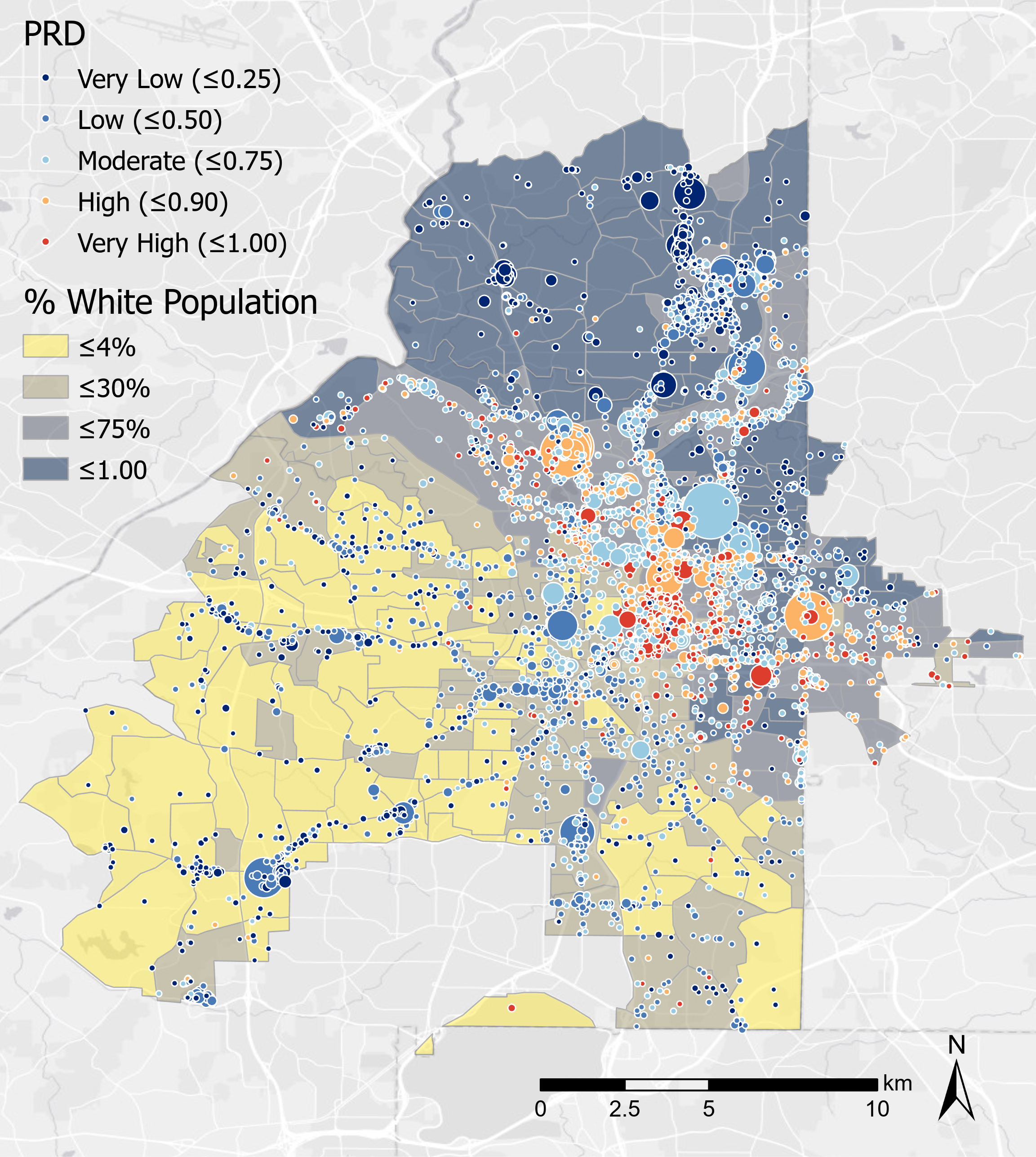
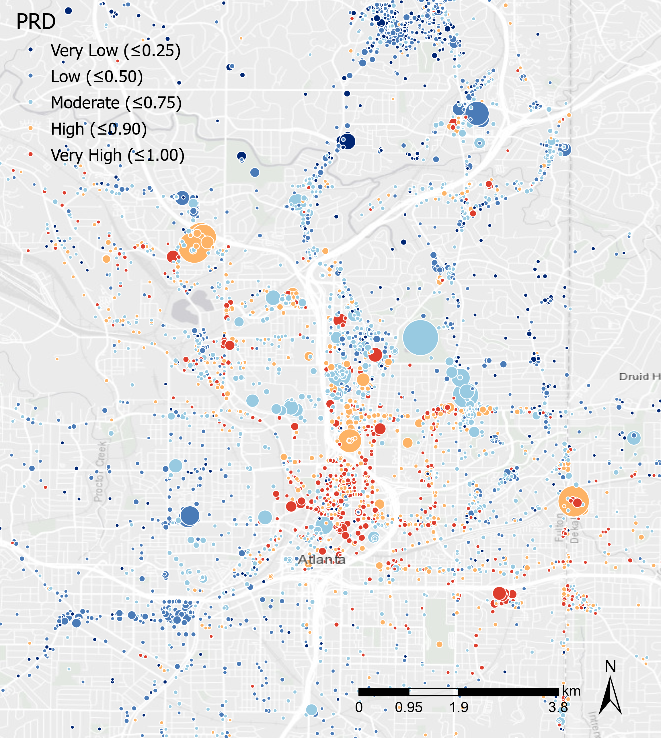
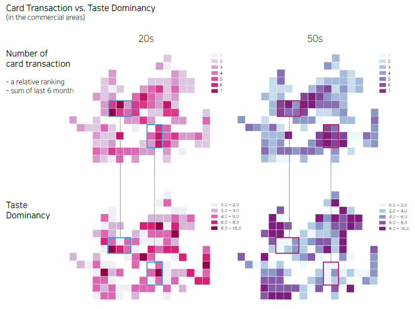
Estimating Diversity at Points of Interest (POIs) in Atlanta, Georgia using Origin-Destination Trip Data
Conference Presentation, Association of Collegiate Schools of Planning (ACSP) 2021 Annual Conference, 2021
Third places (e.g., cafes, bars, parks, hair salons) provide chances to meet diverse groups of people and have social interactions with them. Then we may ask, what types of places provide us more social diversity? In which neighborhoods can we find the socially diverse places? In this study, we explored the questions by estimating racial and income diversity in the third places in Alanta, GA, by using big origin-destination trip data collected from mobile GPS sensors. The study demonstrated that the social diversity in places differ by the type of places (e.g., food outlets vs. health care), residential demographics, and ongoing neighbhorhood changes around the places. To better understand the relationships, we call for contextualizing the measures by working with community members more closely.
Inferring the Commercial Landscape using Age-biased Online Search Results
Conference Paper, In UbiComp 2019 Adjunct Proceedings
What does the different result of age-biased place recommendation tell us about a place? How does the restaurant preference of different age groups correlate with actual commercial activities at a place? In this study, we analyzed the consumer-age-specific patterns of restaurant preferences in commercial areas of Seoul, through the mining of place recommendation results from the Naver Place online service. Our results suggest that both high-traffic and rapidly changing commercial areas present diverse options appealing to all age groups and that this diversity is primarily driven by the tastes of younger age groups. Read the paper
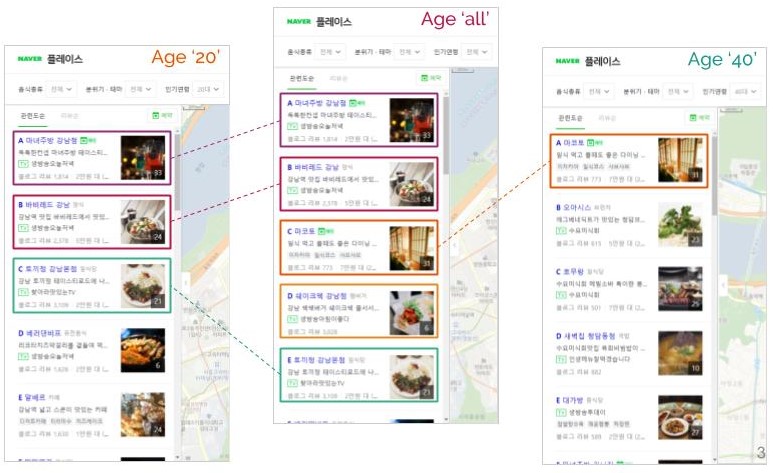
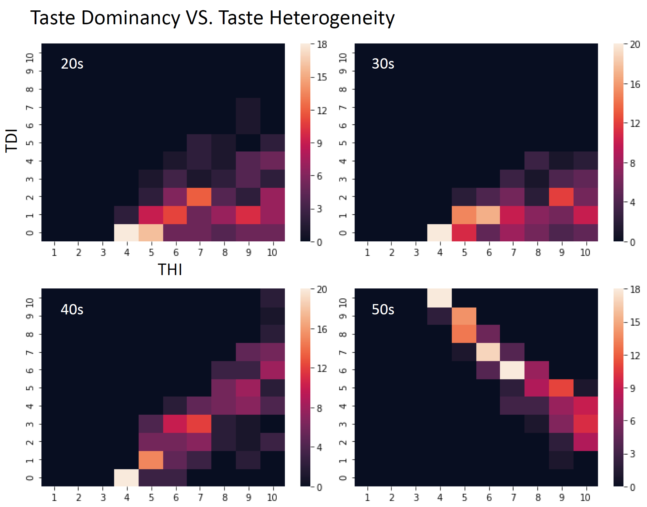
Publication: Lee, D., Lee, S. Inferring the character of urban commercial areas from age-biased online search results: how place recommendation data can reveal dynamic seoul neighborhoods, In Ubicomp 2019 Adjunct Proceedings
Who Has Local, Global, Glocal Set of Connections?: Classifying Individual Spatial and Social Networks
Conference Paper, NARSC 2020
All individuals connect to a set of places with which they interact through travel, migration, location of social ties, telecommunication, and more abstract thoughts and proclivities. Collectively, these are known as social flows and form a star-like pattern that is spatially embedded. In this study we classify the connection sets (e.g.travel, migration, relationships, etc) reported from a survey into distinct typologies and investigated their correlation with individual and behavioral factors regarding social, spatial extensibility. Read the abstract
Presentation: Liang, X., Lee, S., Andris, C., Chen, H., and De La Pena, B. Characteristics of Individuals with Global, Local or Glocal Connectivity Patterns, NARSC, 2020
Civic Paticipation and Media
How can we enhance the identity and capacity of communities as designers of their living places?
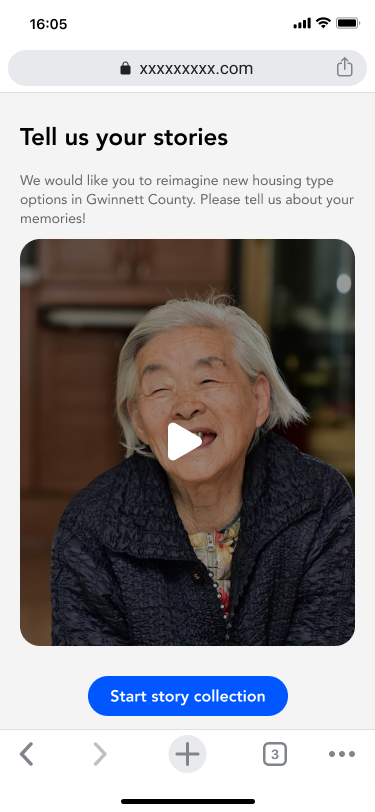
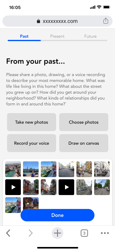
Digital Cultural Probing Tool: Collecting Lived Experiences of Senior Immigrant Communities
Course Project, ICT and Global Development (Technology & Equity), Georgia Tech, 2020
Immigrant populations, especially those of senior age, encounter intersectional barriers to community engagement in urban planning. Eurocentric city planning discourages them to reflect on their lived experiences in respective home countries. The language and cultural barrier hinder authentic communication between authorities and immigrants. To overcome these barriers, we developed a digital cultural probing tool that collects lived experiences, memory, narrative, and artifacts. We aimed to support city planners with this tool that enables learning about ways of planning outside of conventional Western methods. Read our final report.
Returning Gendered Playground to All: Participatory Design for Inclusive Playful Places
Pariticipatory Design Workshop, Yangji.Co.Ltd, 2018
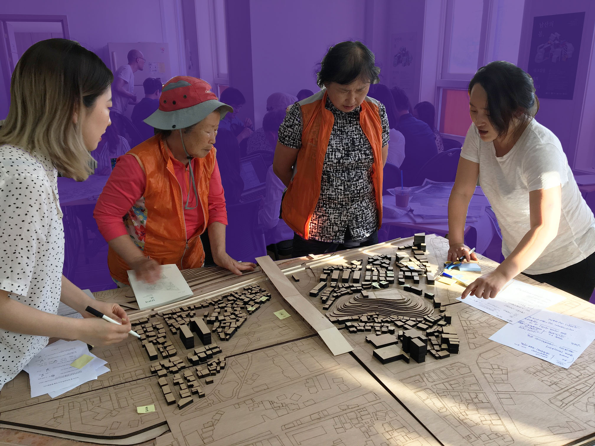
During the urban regeneration project in Cheon-an, South Korea, we run an open studio, where residents can walk in and freely participate in the urban design process with architects, planners, and designers. Conversation with elderly women revealed that the neighborhood didn't have a place for elderly women to PLAY. With additional field investigations with the residents, we found that most of the public spaces in the neighborhood are highly masculinized: the huge shade under the bridge was used as a gambling yard for old men, and the enclosed green spaces were rarely used by women because they felt unsafe and even threatened in those spaces. These findings led us to aim to return the gendered, threatening playground to all. In the final pesentation, we suggested to redesign the public spaces with three design principles: to make the places visually open, connected as a network accessible to all, and to place more inclusive and engaging programs.
Mobile App for Commutnity Engagement
Mobile App Prototyping and Pilot Implementation, Yangji.Co.Ltd, 2018
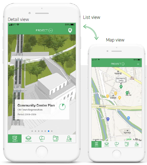
Namsan-Maeul Talk is a mobile app to help people understand convoluted urban plans and enable them to engage in the process ubiquitously. In a series of participatory workshops, many residents told us that they had a hard time understanding the plans and announcements which hindered them to discuss the issues with others. To lower these barriers and help citizens to be better aware of the process of plan implementation, this app provides residents a real-time progress dashboard and proactive notifications of any actions or changes pertaining to the plans. It also provides a platform for organizing neighborhood events. The app was introduced as a pilot program and tested on-site during the workshop period.

Indigenous Eco(-nomic) System: Community Mapping and Networking of Local Assets for Economic Empowerment
Participatory Workshop, Strategic Design, Yangji.Co.Ltd, 2017
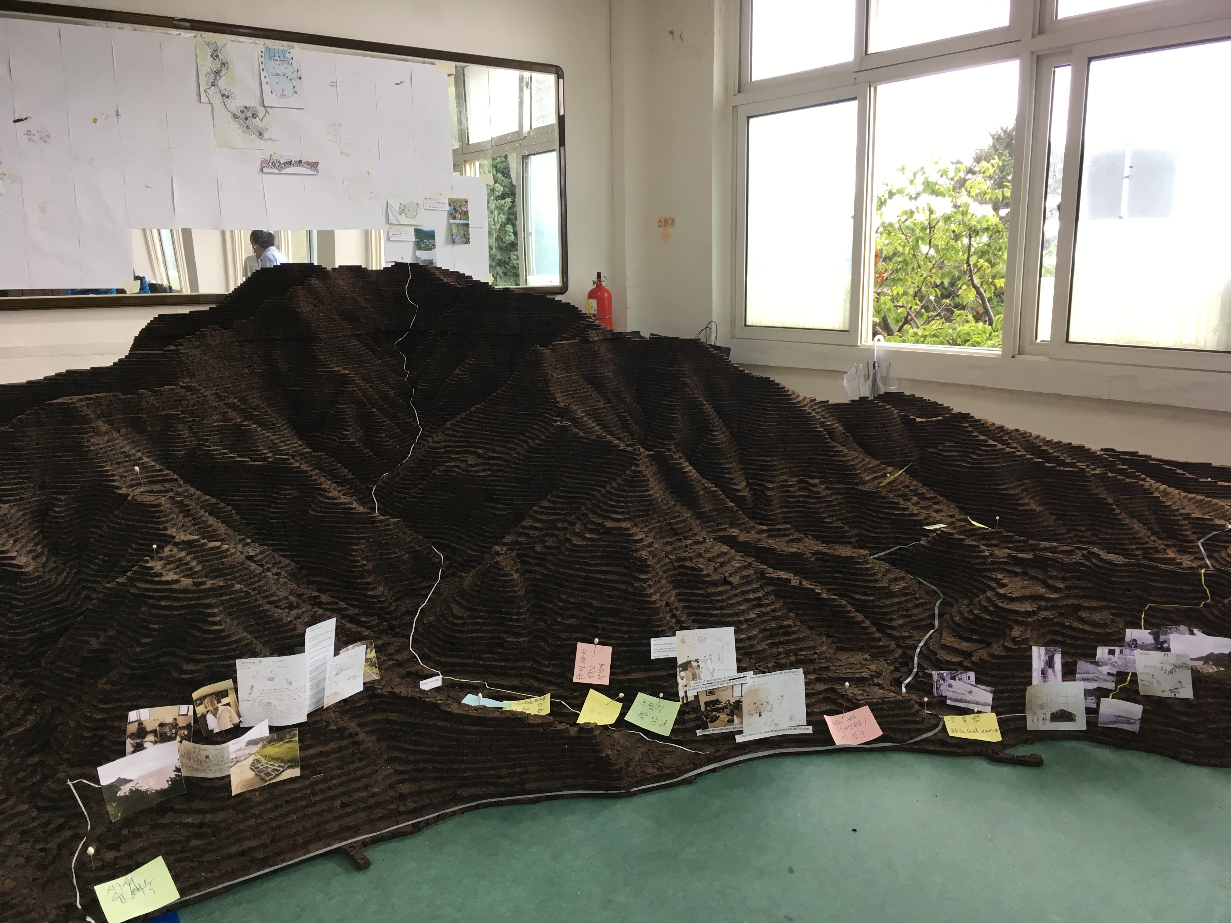
What would be the way for a shrinking community in a rural island to reinvigorate their tourism economy while they prevent an enormous foreign capital poured in? In the participatory workshop held on an island currently under threat of massive development, we recovered overlooked components of an indigenous ecosystem and created a network of local assets that helps to create sustainable profit-making programs. The result inspired a community-led economic development project which was implemented following the workshop.
Human Experience Design Research
Design becomes alive when it meets people, bringing unique experiences. I studied and assessed urban space through the lens of human activity and perception.
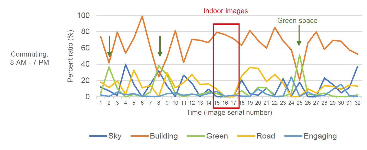
Augmenting the Visaul Experience on GPS Tracks using ML Techniques
Course Project, Urban Ecological Design, 2019
GPS tracking gives us granular spatio-temporal information about how people move and do things in cities, yet the experiential context we can earn from the data is highly limited. In this class project, I adopted machine learning algorithms (classification and image segmentation) to infer two contextual information of daily movements from GPS track data: 1) trip purpose and mode, 2) visual component achieved along a trip. Trips for a day of 860 individuals in Tokyo, Japan were processed and the result answers the following questions: Where do people pass by for their daily trips? How would be the scenes they see along with their trips? Is it different when you take a trip for different purposes? like when you commute, do some daily tasks, or go to hang out?

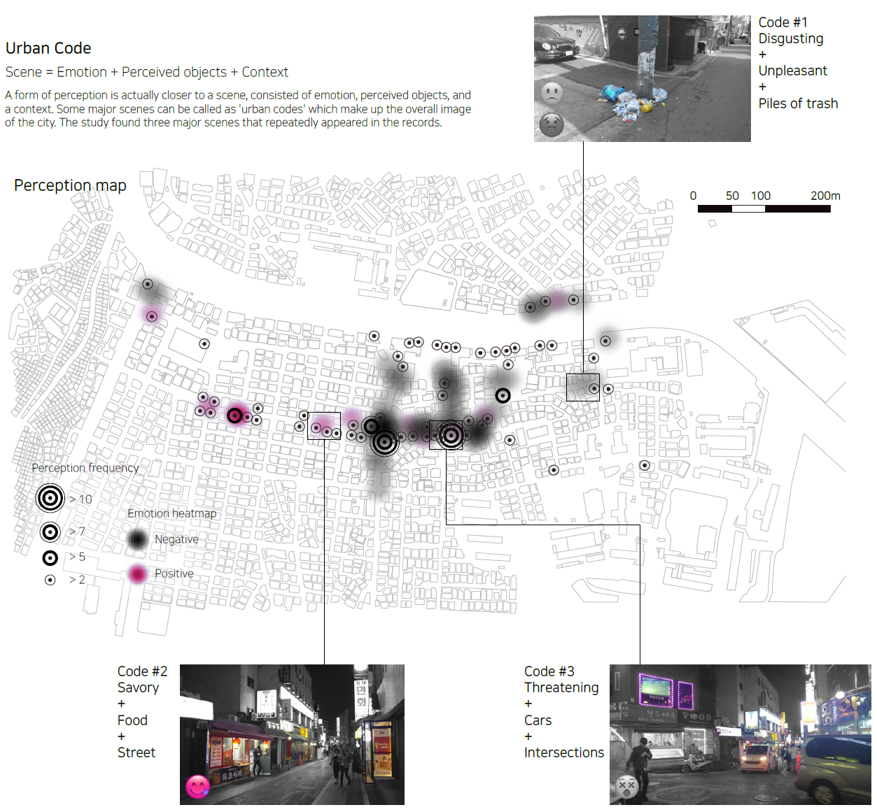
Urban Code: Characterizing a Neighborhood by Perceived Object + Sensation + Emotion
Undergraduate Thesis, Seoul National University, 2018